For best experience, use Nutshell app on your smartphone.
For best experience, use Nutshell app on your smartphone.


For best experience, use Nutshell app on your smartphone.
For best experience, use Nutshell app on your smartphone.


5:03 pm on 10 December 2022, Saturday
by Jade Veronique V. Yap
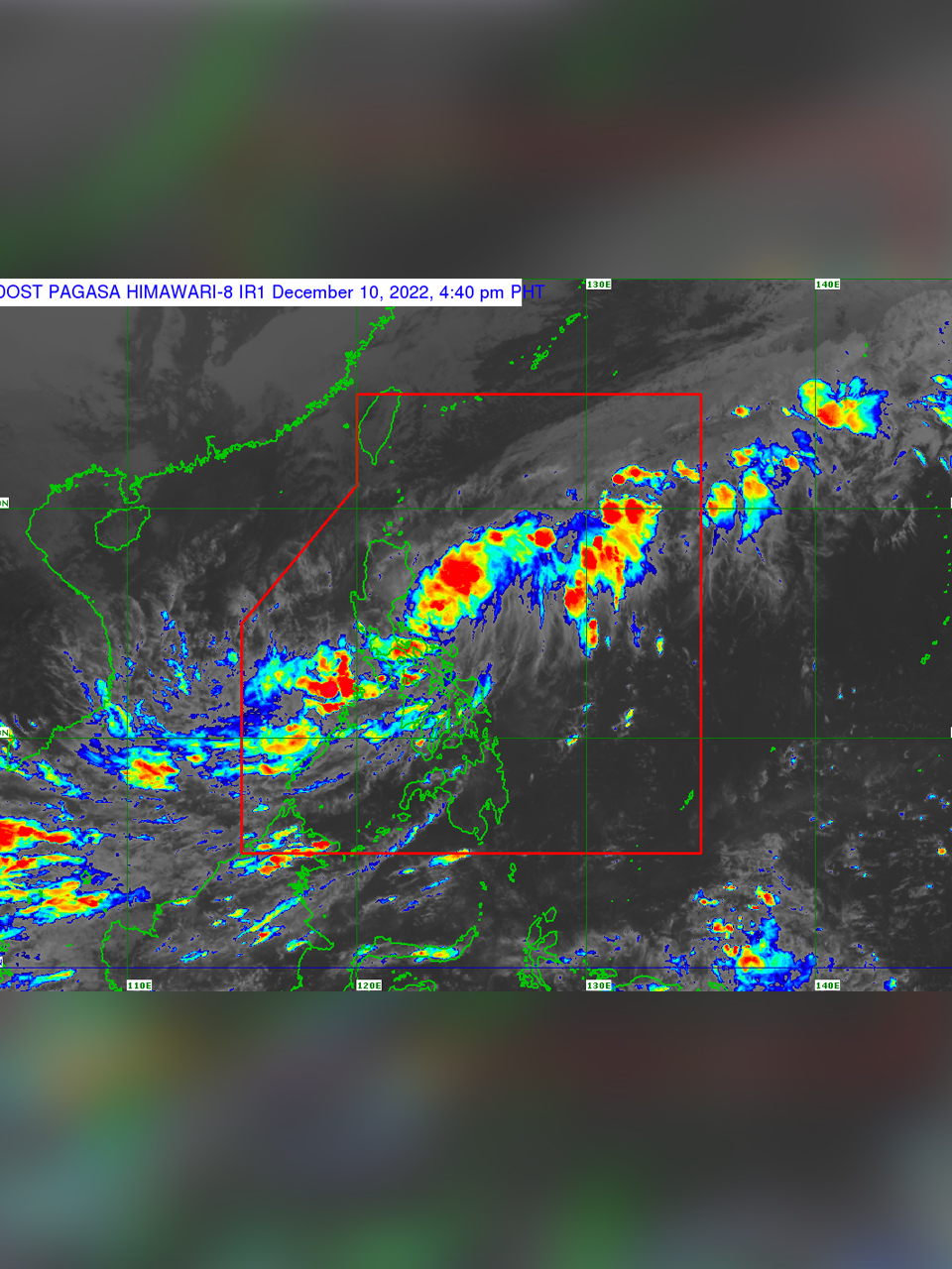
The Philippine Atmospheric, Geophysical, and Astronomical Services Administration (PAGASA) placed three areas in Bicol under Signal No. 1 on Satuday, December 9, as the low pressure area northeast of Virac, Catanduanes intensified into Tropical Depression Rosal.
According to PAGASA's Friday weather bulletin, Rosal was last seen 110 kilometers north northeast of Virac, Catanduanes, moving northwestward at 20 kph and has sustained winds of 45 kph near the center and gusts of up to 55 kph.
Signal No. 1 are hoisted in the following areas:
- Catanduanes
- Eastern portion of Camarines Sur (Caramoan, Presentacion, Garchitorena, Lagonoy, San Jose, Tigaon, Sagñay)
- Eastern portion of Albay (City of Tabaco, Bacacay, Rapu-Rapu, Malilipot, Malinao, Tiwi)
Under Signal No. 1 intermittent rains with winds of 30 kph to 60 kph are expected for at least 36 hours.
PAGASA also said these areas may experience strong winds—strong breeze to near gale strength—associated with tropical depression Rosal.
Meanwhile, moderate to heavy with at times intense rains are expected over the Bicol region and Quezon, while Mimaropa and Western Visayas may experience moderate to heavy rains and light to moderate with at times heavy rains are forecasted over Aurora and the rest of Calabarzon and Visayas.
PAGASA also said that Rosal may also bring light to occasional heavy rains in Bicol Region, Quezon and Aurora on Sunday, December 11.
"Under these conditions, flooding and rain-induced landslides are expected, especially in areas that are highly or very highly susceptible to these hazards as identified in hazard maps and in localities with significant antecedent rainfall," PAGASA warned.
PAGASA also issued a warning that sea navigation in small vessels may be hazardous across Central Luzon's coast as well as the eastern and western coasts of Southern Luzon, where the Northeast Monsoon and Rosal may bring moderate to rough seas.
Due to its interaction with the Northeast Monsoon, or Amihan, Rosal, which is forecasted to intensify into a tropical storm in the next 24 hours, may weaken into a tropical depression on Monday and a low pressure area on Tuesday.
"Rosal is forecast to decelerate while moving generally northward in the next 12 hours before turning north-northeastward or northeastward for the remainder of the forecast period. However, due to the interaction with the northeast monsoon (amihan), the tropical cyclone may weaken into a tropical depression on Monday (Dec. 12) and become a remnant low on Tuesday (Dec. 13)," PAGASA said.

Stay updated wherever, whenever. Nutshell is the go-to app for summarized yet informative news right in your hands. Download for FREE.


© 2018 by Nutshell
Powered by ![]()