For best experience, use Nutshell app on your smartphone.
For best experience, use Nutshell app on your smartphone.


For best experience, use Nutshell app on your smartphone.
For best experience, use Nutshell app on your smartphone.


2:09 pm on 26 October 2022, Wednesday
by: Jade Veronique V. Yap
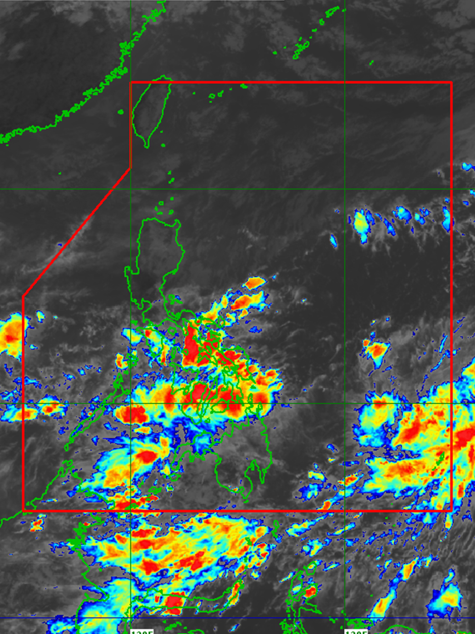
The Low Pressure Area (LPA) spotted east of Eastern Visayas has now developed into Tropical Depression Paeng, the state weather bureau PAGASA said, Wednesday (October 26).
According to PAGASA's 11 a.m. weather forecast, Paeng was last seen 965 kilometers east of Eastern Visayas. It is moving slowly westward and northwestward, with sustained winds of 45 kph near the center and gustiness of up to 55 kph.
PAGASA said Paeng is forecast to track generally westward until tomorrow afternoon (October 27), then it will turn west northwestward for the remainder of tomorrow (October 27) through Saturday (October 29) morning. Afterward, PAENG will begin to move northwestward on Saturday afternoon or evening.
The tropical depression, which is expected to intensify into a typhoon this weekend, may pass close to Northern Luzon on Sunday (October 30) or Monday (October 31).
No Tropical Cyclone Wind Signal is currently hoisted, but PAGASA did not rule out the possibility of hoisting wind signals over some areas in Eastern Visayas and the Bicol Region as early as tomorrow morning (October 27).
Meanwhile, from Friday morning to Saturday morning, heavy to intense rains, at times torrential rains, are possible over the Bicol Region. Moderate to heavy with at times, intense rains are expected over Eastern Visayas, Mindoro Provinces, Marinduque, Romblon, Quezon, Aurora, Isabela, and Cagayan. Rizal, Laguna, Nueva Ecija, Bulacan, Cordillera Administrative Region, and the rest of the Visayas and Cagayan Valley may experience light to moderate rains, with heavy rains possible at times.
Heavy to torrential rains are possible over Cagayan, Isabela, Apayao, and the northern portion of Aurora. Moderate to heavy with at times, intense rains over Ilocos Norte, and the rest of Aurora, Cagayan Valley, and Cordillera Administrative Region. From Saturday morning to Sunday afternoon, light to moderate rain with periods of heavy rain is possible over Western Visayas and the rest of Luzon.
PAGASA also warned of the possibility of flooding and rain-induced landslides, particularly in areas identified as highly or very highly susceptible to these hazards on hazard maps and in areas with significant antecedent rainfall.
PAGASA added that due to the shear line and Paeng trough, it is likely for Quezon, the Bicol Region, Visayas, and the northern and western parts of Mindanao to experience heavy rains as well.

Stay updated wherever, whenever. Nutshell is the go-to app for summarized yet informative news right in your hands. Download for FREE.


© 2018 by Nutshell
Powered by ![]()